

OpenStreetMap & Leaflet - Angular
Angular
Curious to know how to implement some interractive maps in your projects ? Want to make use of public data to enrich your map and fit your needs ?
Follow this quick guide...
Easy setup
Your existing angular project requires the Leaflet library to manage map datas. We are here using OpenStreetMap, but you can use any convenient map service you want, such as GoogleMap or any other.
npm i leaflet@latest
After install, generate a dedicated component called map.
ng g c map --skip-tests
The template of this component will contain the map object, assigned to a div with an id named map, like this :
<div id="map"></div>
As you need to access the #id element of the DOM for inserting the map, you require to initiate the map in the AfterInitView lifecycle hook.
The Leaflet library is imported as L, and all the components will be derivated from it (L.Map, L.marker, L.popup etc...). The map is defined by the id tagname (for targeting insertion) and some options such as map center coordinates and zoom value. This part of map is made of a lot of tiles on a layer you have to call with the right service URL. This is where you call the OpenStreetMap service, or any other you want.
You finally add these tiles to the map you just created.
import { Component, AfterViewInit } from '@angular/core';
import * as L from 'leaflet';
@Component({
selector: 'app-map',
templateUrl: './map.component.html',
styleUrls: ['./map.component.css']
})
export class MapComponent implements AfterViewInit {
private map;
private initMap(): void {
this.map = L.Map('map', {
center: [ 39.8282, -98.5795 ],
zoom: 3
});
const tiles = new L.tileLayer('https://{s}.tile.openstreetmap.org/{z}/{x}/{y}.png', {
maxZoom: 18,
minZoom: 3,
attribution: '© <a href="http://www.openstreetmap.org/copyright">OpenStreetMap</a>'
});
tiles.addTo(this.map);
}
constructor() { }
ngAfterViewInit(): void {
this.initMap();
}
}
The tiles will appear in the wrong order, so you need to add "./node_modules/leaflet/dist/leaflet.css" to the styles parameter of angular.json.
All the additional tools, like markers or popups, will be added to the map object in the AfterViewInit lifecycle hook.
Services
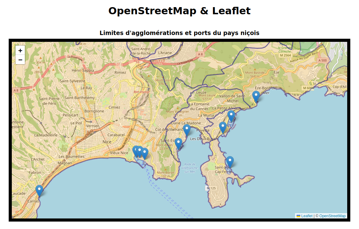
To add informations to enrich your map, you will have to access data with geoJSON format. I currently used open data from the Nice city in this website. These static datas are placed in assets/data, but you can of course access data from an API to get more fresh and updated values.
// Marker Service
import { Injectable } from '@angular/core';
import { HttpClient } from '@angular/common/http';
import * as L from 'leaflet';

@Injectable({
  providedIn: 'root'
})
export class MarkerService {
  ports: string = '/assets/data/localisation-des-ports.geojson';

  constructor(private http: HttpClient) {
  }

  makePortMarkers(map: L.map): void {
    this.http.get(this.ports).subscribe((res: any) => {
      for (const c of res.features) {
        const lon = c.geometry.coordinates[0];
        const lat = c.geometry.coordinates[1];
        const marker = L.marker([lat, lon]);

        marker.addTo(map);
      }
    });
  }
}

// Map Component
...
constructor(private markerService: MarkeService) {} // don't forget to import the service!

ngAfterViewInit(): void {
    this.initMap()
    this.markerService.makePortMarkers(this.map)    // call the service's method with the map as a parameter
}
The global idea is to make up some services calling the data sources with HttpClient module in order to setup observables you will subscribe to in the AfterViewInit map component.
You can see a demo of this app in my demo page.